Feeds:
Posts
Comments
Aaron Kilpatrick home and art studio at 340 Olive painting by William Wendt

There are a lot of interesting little gems in Morro Bay to look at. I don’t know the history of them all… but I do know a bit. I spent this morning wandering around noting places that stand out to me from south of a line I’ve arbitrarily drawn at Olive street and Ridgeway up to Kern. This is by no means an exhaustive survey of all the interesting architecture… it’s just me wandering around and looking. Many of them are rather quiet and don’t jump out at you… but they provide a feeling that makes this place feel like it does. I’ll go street by street to make it easy to follow along. I’m not gonna do all the streets though. I’m also not gonna include photographs of all these places because it felt too intrusive. You can find them on google earth street view if you’re lazy… but best to just get out and take a walk.

Beginning along the lower State Park Road (aka Main Street) at the south end of town:

Maybe start (or finish)with lunch at Bayside cafe. Order the tri tip tostada… I prefer the black beans but the pinto are good too… (or 50/50!) have them add grilled onions because it’s just better that way. Get an Arnold Palmer to go with.

Walk east from there about half way down the marina parking lot and look north towards the camp ground… across State Park Road. Check out the Board and bat and stone restrooms at the state park. Who designed this little building? I know it was built by the Civilian Conservation Corps. They also did many of the other fixtures around the state park, most notably the gutters along the upper state park road that goes through the golf course known as “park view drive”.

Restrooms at Morro Bay State park built in 1934 by the Civilian Conservation Corps

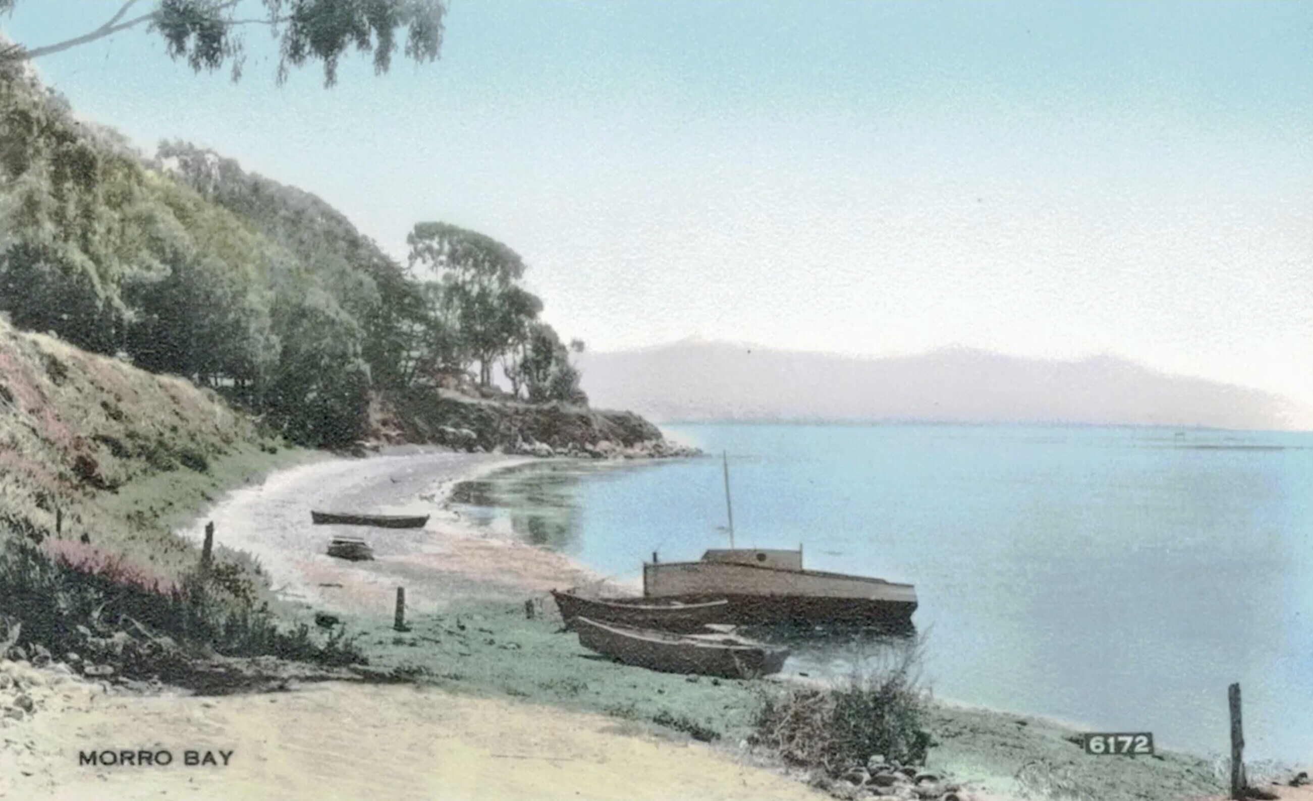
20 State Park Road- Natural History museum at Whites Point. I’m curious who designed this mid century modern building. it’s best viewed from the water or from “windy cove” (the little parking area on the mudflat edge just north of the museum). Walk the little trails around the small little rocky outcropping and above the museum…. Take the stairs up to the top of this rock and check out the Indian bowls carved into the rocks… and the view!

Walk north along state park road on the west side. There’s a trail. Cross past windy cove and the mud flats and look back at the museum. This spot at the mudflats here is where I have spent every King Tide Event at high tide. Back in the seventies the bay crossed the road here once and flooded out into the fairway of the golf course. But since then the road was repaved so now it’s about 2” taller and thus the water hasn’t crossed the road since. I keep waiting… but the water only gets to the west edge of the paving now though. Sandal… the “baykeeper” of Morro Bay used to anchor just at the north end here (google him).

60 State Park Road- the Inn at Morro Bay…. Which to locals will always be known by it’s original name: the Golden Tee. This motel has been highly remodeled with brick pavers and a cottage vibe but was originally a 60’s mid century rat pack sort of place. The main lodge still has a bit of this vibe if you go inside and look at the bar and restaurant. Google “the Golden Tee” and you’ll see lots of period menu’s and postcards etc. They come up on eBay a lot. The buildings were originally designed by local modernist architect John Ross. There was a $920,000 public stock offering offered to fund the build of this place. The folks behind the original corporation were Glenn Kleinhammer, Eugene Morosin, Milton Rohrberg, and Chrome John’s. Architect Ross also designed homes for Kleinhammer and Rohrberg just up the hill a few lots.

Immediately south of the the Inn at Morro Bay is the Heron Rookery on a point known as Fairbanks point. The old Fairbanks house used to be in this spot here long before anything else was in this part of town. Imagine living on this bay front parcel back in the day. The driveway to this house went along the bluff northward up to main street… several thousand feet long… before the motel, and before the condos north of the motel. It entered Main Street just where 199 Main Street is now. The Fairbanks house was a sort of arts and crafts style.

199 Main- cool old brown shingled cottage overlooking the old fuel dock.

225 Main- Gladys’ Castle. Gladys Walton was a silent film star. She covered her house in shells and stones and built both the lighthouse in front of this place and the windmill house across the street.

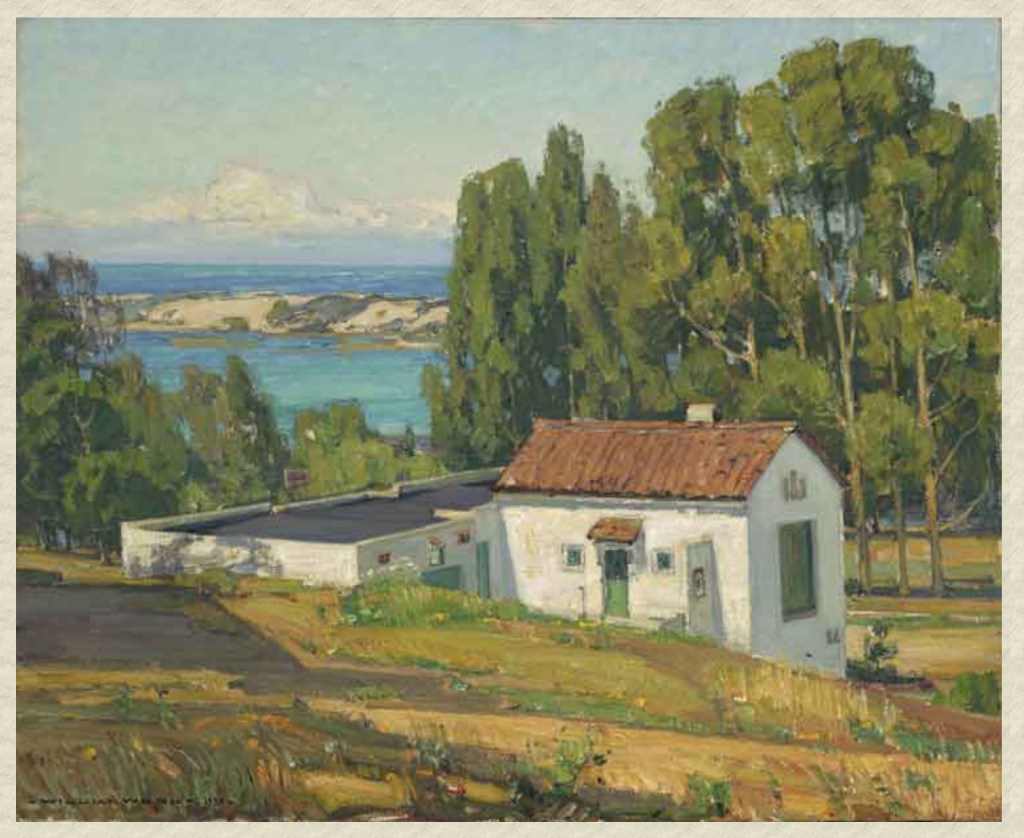
235 Main- (approx… address) Orval League’s Oyster Cannery. Designed by architect John Badgley. Best views of this building are from the water on a boat. Part of Morro bay’s commercial fishing industry. It’s quite a nice looking mid century design from the water. Hard to see it from the street.

280 Main- Big Sur modernist style redwood concrete and glass home of my dad, architect Gerald (Gerry) Rupp. built early 1950’s. This house marks the southern edge of what was known as “beatnik hill” back in the day. It’s also the southern edge of the artists colony on Cerrito Peak that existed from the 1930’s through the 1970’s.

Take a short side trip up Cypress here… behind 280 Main because in the early 50’s my dad, Gerry Rupp, built 2 other little redwood, glass, concrete and stone modernist houses at 270 and 290 Cypress. SLO Architect Roger Marshal designed a fantastic art studio addition to 290 Cypress on the lot at 280 Cypress but you really can’t see much from the street. A nonagenarian longtime local artist has lived here for approx 70 years. This house began as an A-frame… but then it grew!

Looking south from Cerrito peak towards 290 Cypress street A-frame approx 1951… before most of the houses in the neighborhood. This house is now in the center of the block buried in trees and almost impossible to see. Note the 1930’s and 1940’s cars
290 Cypress street 1951 or so. Note the big flat roofed south facing cantilevered dormer bedroom upstairs.

301 Main- this mid century house looks right out over the boat launch at the south end of the embarcadero. It’s better to view it from down there. One of the best front decks in town. To get down there walk north to Olive street…turn west.. walk down to the stairs on the bluff and walk south along the embarcadero towards the boat launch.

North of 301 main are several old original cottages between Main Street and the embarcadero that feel same way they did decades ago. Very original Morro Bay feeling here. When you get to Fig street… look at the two red houses across Main and up the hill. Behind these red places…if you look between them… you can just barely see a third red house with white trim. It used to be the only house on this block. It’s a cool old 1930’s crafstman cottage high up on the hill.

Fig street takes off west here for about 150’ and has several original humble cottages that have not changed over the years. Nadine Richards home and art studio are just below the bluff here… at the bottom of Fig…. Accessed by a bridge. But it’s actually on the embarcadero parking lot for the boat launch. She was an artist and a character. She built her house herself down at her parents place south of Fig street… but drug it with a tractor up to where it is now and placed it over her art studio. There’s a ladder between floors. No stairs. Artist Everette Jensen’s art studio and home was the little house behind the hedge on the embarcadero just south of Nadine’s.

340 Olive- Spanish colonial revival. Originally the home of artist Aaron Kilpatrick. He hung out with artist William Wendt… and they both painted all over Cerrito Peak behind here… which they called eagle rock probably because at the top it feels like a big stone eagles nest. … but it’s a volcanic plug. you can access the trail up Cerrito peak from the high point of Cerrito Place just up Olive a tad. Nadine and Aaron and William were all friends and confidants.

370 Olive- known as “the hunting lodge” but I don’t know that story very well. It was also home to artist Charlotte Skinner.

400 Olive- I just like A-frames

Walk up Olive and turn right on Cerrito Place…. Walk up to the bend in the road and look on your right for the “trail” sign between the eucalyptus trees. Hike the short way up to the top. The views are worth it. This is a fantastic small hidden park. Be respectful of neighbors and don’t go near any of the homes. Lots of boulders and cliff… so watch out. Head back down and east on Cerrito to Shasta Left, Olive Right, Piney Way right, and ridgeway Left. Walk up ridgeway.

View from Cerrito Peak by William Wendt.

800 Ridgeway- a classic old cottage

805 ridgeway- Spanish colonial revival (with later additions) and with some great trees

850 ridgeway Spanish colonial revival

880 ridgeway. Interesting old triangular parcel with an old MB home. Wish I knew the story.

900 Ridgeway- home and studio of Artist Arther Harold Knott. Later home to his daughter Harleigh. When she died she gave it to Stanford university and they sold it to a couple from SLO who hope to restore it eventually. Harold Knott was a well known artist like Kilpatrick down on Olive. It’s known as “the house of the seven winds”. It is a cape cod style home designed in 1925 as a summer cottage for Mrs G.A. Martell by architects Miller and Warnecke out of San Francisco. She never lived there as far as I know. Harold Knott added his art studio in the SE corner of the lot just after he bought it in 1929 or so.

Home of artist Arthur Harold Knott on corner of Ridgeway and Kern
900 Ridgeway Main house plan circa 1925
Hand drawn plans
Studio originally was going to have a kitchen, bath, and bedroom off the east side… but this was never built
Harold Knott’s Art studio behind 900 Ridgeway.

Walk south down Kern. Watch for cars because there’s no shoulder and it’s a tad sketchy.

350 Kern- cool art deco house. I don’t know the backstory. It’s old though. One of the first 4 or five in this area. Who know’s the story? one of my favorite houses in town.

320 Kern- this place intrigues me because I think it used to also include 310 Kern… before the house at 310 was there. The house at 320 looks sort of Hawaiian. It has a Hawaiian hip roof. The cottage on the rear of the 310 lot, which you have to really snoop to see, also has this Hawaiian hip roof design and appears to have been a guest house for 320. I dunno for certain but would bet. There’s a fantastic back yard here too…. Check google maps!

300 Kern- Spanish colonial revival home with a lovely courtyard and great details. Another of my favorite houses in town.

246 Kern… looks older than the nearby houses. Don’t know the story. I like it.

140 Kern- Bud Anderson home. He is a famous local. He started the Galley restaurant among other things. Sort of a 60’s or late 50’s slumpstone fake Adobe post and beam rancher. Garage on east end was filled in with bedrooms I think. Sneaky not so secret path to the golf club is behind (east) of this home.

130 Kern- mid century modern designed by Don Smith. South facing courtyard.

101 Bradley- directly across Kern from 130 Kern. This house was home to the “donut lady”. She owned the little donut shop on the waterfront where the beef jerky place is… next to the kite shop at the end of Beach. She sold coffee and donuts to the fishermen and surfers. The Formica countertop was worn completely through next to her cash register where she slid probably 20 million in coins across the counter to buy 25 cent donuts. For some reason there were never more than about 20 donuts in the case. Her name was Ramona… but I forget her last name. She owned a LOT of commercial real estate in MB. Donuts… who knew?

That’s it for this walk… there’s plenty more. Now you have to walk back to your car at the marina. Sorry. Best not to use the golf course. Makes the golfers cranky.

This is the stretch of Morro Bay I used to play on as a kid. This postcard view of the cove is from before I grew up. In the 1960’s a motel resort called “the Golden Tee” was built on the southern edge of this cove. It’s now called “the Inn at Morro Bay”.

Just North of this spot was Orval Leage’s oyster processing operation and fish market. We locals called it “the Oyster Plant”. The entire stretch of shore here was covered in left over oyster shells… millions of them probably 6 feet deep. Occasionally we would find a huge abalone shell amongst the oysters… probably 10″ or more across. Orval lived in an interesting mid century modern redwood house designed by George Nagano three blocks away…. but we never called it “mid century modern” back then.

Along this stretch of the bay were dozens of small row boats. We kids would take our oars down and “borrow” these on occasion. Much easier to just own oars than the whole boat. We would go over to the sand spit to play… and then return the boat to wherever we had found it after a hour or two.

There was a small fuel dock pier you could walk out on… with adjacent docks for a few dozen fishing boats. It had a small snack bar sort of place with drip coffee and crappy potato chips and stale candy… and scruffy fishermen in old Ben Davis Jeans bought from Giannini’s Marine Supply and navy blue knit caps from Horton’s Army Navy store. We fished off the pier here… mostly caught perch. Gilbert’s market was up on Main Street in front of the Oyster plant. You could smell the chickens he roasted daily at our school bus stop out front. Gilbert and Diane Chan lived about 300 feet away from their store.

A silent film star named Gladys Walton lived next to Gilbert’s Market. She covered her house in shells… sort of like what you see in the old southern Florida Keys area. She also later built a fake lighthouse on the edge of her bluff. Her weird boyfriend stared at the girls at the bus stop through a hole in the fence.

The oldest house on the hill we lived on belonged to an old Portuguese fisherman named Mr. Molina. I never knew his first name despite living across the street from him for years. His house was probably from the late thirties… it was painted that same red you see in a lot of Portuguese villages. You used to see it all over MB too… Nadine Richard’s house down on the parking lot of the boat launch was that color… and the house with the wooden tower in the Eucalyptus trees on Morro street too… the one that hotel got built in front of and ruined it’s view. These Portuguese red houses always had white trim…. board and bat… probably old redwood. He built walls and pathways around his property out of old concrete chunks and rocks and shells and old broken plates set in mortar… and an old cement pond, now cracked, that no longer held water but instead was filled with too little dirt and succulents and scraggly flowers.

Mr. Molina had an old VW beetle that was missing first gear. He would drive it around the block several times gathering his wits until he got it just right so he could swerve up the hard left to his drive and just barely make it up to his garage at the top of the property in second gear… the old bug struggling mightily the last few feet.

He had a huge old apricot fruit tree just down the hill from his garage and every winter he would get a length of chain and beat the tree with it. I finally gathered up the courage at the age of about 8 to ask him why he did this. “Makes it think it’s had a bad winter so then it produces more fruit to make up for it” he said. It was true… that tree was heroic in the amount of fruit it produced. Never the less I felt sad for it when he whipped it with that chain every winter. After he died the tree never produced again. I sorta figured it was relieved to finally get to retire.

Condos got built above the cove… on the north part… lots of them. The contractors unknowingly supplied plywood for a few skateboard ramps in the neighborhood. A little park was made under the trees at the bluff edge in front of the condos… and a public restroom. And a set of stairs now leads you down to the water where you can still find a few old rowboats… but mostly it’s plastic kayaks now. Most of these condo’s sit empty because they are second homes… so the park feels a bit desolate. Almost the way the empty lot that preceded it did… but not.

In the 60’s a character named Sandal (he evidently made sandals at some point in his life and the name… well you get the idea) lived on a scrappy boat of his own making. He skirted the law by dropping anchor here and there along this cove. Much to the chagrin of the Golden Tee motel/resort’s owners. He was a hippy of sorts. He called himself the “baykeeper”. He was a naturalist in various interpretations of that word. His boat was like a Japanese junk made from plywood. He was well known around town… and people just sort of accepted his raggedy presence and thus the city manager and police and harbor patrol just sort of ignored his illegal harbor residency. His son Paka would follow him around and their plight was the worry of empathetic mothers all around the area. Later in life he left Morro Bay’s jurisdiction for reasons I am unaware of but can guess… and anchored off of baywood… in the area patrolled by “the baywood navy” who’s slogan is “we won’t sail in water any deeper than we can stand in”. Today Sandal would have been dealt an altogether different set of circumstances by a variety of public agencies.

The hill we lived on was called Cerrito Peak. But we kids all called it eagle rock. I’m not sure where that name came from… but later in life I found out that an artist named Aaron Kilpatrick had formerly lived in the little Spanish house on the corner of Main and Olive and he had, at one point in his life, lived in Eagle rock California. He and William Wendt… another now famous Plein Air Painter had spent a lot of time on Cerrito Peak painting various views. I dunno if there is any connection but if I speak with enough authority in my voice about “the origin of eagle rock” people believe the story.

We kids had names for all the rocks up on Eagle Rock. “Sleeping Beauty Rock, Squeeze Rock”, “Death Rock”, “Butt Rock” etc. This hill was our other playground. It was in semi neutral territory between three distinct neighborhoods as defined by the “gangs” of kids in them. I suspect probably at least 20 kids called that hill theirs. Many swings were hung… until parents got wind of them and the fact that the swings usually swang out 40′ over various cliff faces. Good stuff. Many treeforts were built too. One particularly heroic undertaking involving several stories and at least 12 kids to build over the course of three months and many trips to the aforementioned condo contractor’s storage yard in the late evenings.

I left MB as a college kid… off to San Luis Obispo and jr college and then regular college. Then life. Most of the old families I knew have left… or the folks died and the kids had to sell the house because none of them could afford to buy it from the others. A few of them are here still. I got lucky and was able to return. I have coffee mornings with old friends downtown. We talk about real estate… or skateboarding… or goofy things we used to do.

The French have a saying, “je ne sais quoi” which translates to “I don’t know” but really means something like “a quality which cannot be named”. I think this quality describes a place you instinctually know… but are unable to describe properly. It is how I feel about this place.

erichills

Dear SLO:

San Luis Obispo has a maximum buildout of 57,000 residents according to it’s General Plan. Currently (2016) SLO has approx +/- 47,000 residents. Going through the planning process right now there are a total of approx 3000 units within San Luis Ranch, Avila Ranch, the Orcutt Area Specific Plan (area north of tank farm, west of Orcutt road, east of UP RR tracks), and other smaller urban infill sites. (not counting new Madonna housing project behind/south of Home Depot that is being discussed).

At +/- 2.4 residents per housing unit. (SLO occupancy average) these 3000 units will house 7200 people. This leaves SLO with an additional 2800 people to plan for before we meet “buildout”. That means there are only 1167 houses left to plan for… that are not already in the planning process.

SO…

These last 1167 houses and what size/price/location they are… are theoretically all we get. We have to make our best efforts to get these 1167 houses to try and balance the issues we are trying to solve. That… and we need to convince the powers that be that the 3000 homes already in the planning process should also carefully consider who they are being built for.

The real fight I believe… will come once that last 1167th house is planned. I suspect that will happen within the next 5-10 years. (keep in mind that the actual buildout of the 3000 houses listed in the various existing plans… as well as the 1167… may take up to 30 years.)

The city and it’s infrastructure, resource acquisition etc… all have been focused on a max of 57,000 people. But then what?

This is one of the reasons we need to think about the various properties that surround our city that are NOT yet in conservation easements or owned as city open space. Because after we reach max buildout the social pressure is really going to rise. All it takes to change that buildout number is 3 council members. (that’s why I italicized theoretically in my third paragraph above)

In order to assure we don’t sprawl… the solution is conservation easements or public ownership of open space surrounding the city completely. That reframes the growth conversation to only height/density/resource availability and housing price.

Meanwhile… people still seem to enjoy having children…

So if you think there is a fierce discussion going on this now… just wait!  Things are gonna get REALLY interesting once we hit buildout!

Eric Meyer


(Note: The recent legislation about infill studios and tiny homes may pre-empt any local jurisdiction’s ability, within the studio housing category, to create a building moratorium on growth for that studio category, based on a population max.   I’m not sure.)

Photo: Ken Kienow

This morning the Board of the San Luis Obispo Council of Governments (SLOCOG) unanimously adopted the feasibility study over the Corridor that will eventually contain the Edna Price Canyon trail between San Luis Obispo and Pismo Beach.  This will eventually become a segment of the Anza Historic Trail.  This study has been ongoing for the last year or so and is the result of a CalTrans Community Based Transportation Planning Grant.  It was developed by Questa Engineering.

Next steps are the creation of various Environmental Impact Reports (EIR’s) that will cover the various segments of the trail.IMG_2603

The Feasibility Study identified  opportunities and and constraints along various trail segment options.  There are preferred routes… secondary options etc… all of which need to be analyzed in great detail taking into consideration all the various constraints so as to be able to create the best ultimate alternative given the constraints.

It has been about 8 years of work so far.  I started chatting with stakeholders circa 2008.. and that work led to an initial mapping outlined in previous posts… and then advocacy work with the various communities and stakeholder groups along the route.  There are many steps still to go… but we have started… and we are well along the way.

thank you to all the jurisdictions, individuals, and groups that have lent their support.

Eric

This is a map of the average daily time spent commuting to and from work here in San Luis Obispo County published by Trulia. SLO is in the center… San Miguel at the top… and Santa Maria is at the bottom.  Click on it to focus and enlarge it. (bright green is 5 minutes… darker red is 1 hour)   I’m not certain how accurate it is… I just like maps.

(here is a link to Trulia SLO)

commute1

IMG_3092

Last week we had a new sidewalk poured out front of our house… and in it we spontaneously placed a little “love note”.  It almost didn’t happen though… as the concrete was setting pretty fast.    I expect this little gesture will last a few decades or more.    They city guys said it would be ok if we wanted to put our initials in the concrete…  but we thought this might be more fun.  Cynthia had a cookie cutter laying around… and I had the extra chain ring from bike I’d taken apart.  After this photo was taken we dyed the heart red…

What is it that gives a place charm?  Why are some cities memorable and others forgettable?   I think it has something to do with the tiniest of details.  This little art project would have never happened in a condominium development.  The CCandR’s would never allow it.  I would only happen in a place where the city officials and workers are allowed a bit of freedom to make a random decision.  The city guys in our case… made sure it was below the sidewalk such that folks won’t trip on it… and the bolts in it are sunk in about 4 inches… so it won’t come out.

I believe cities need policies written… to allow their workers to be creative like this every now and then.  To allow the citizens to make their own tiny little secret spontaneous art projects.  These things won’t happen if we involve the city leaders in every single one… that would only homogenize the end results.  It needs to be random… perhaps slightly controversial every now and then.

Here is a courtesy link so readers can more easily find my now 3 year old post on the Anza Trail proposal between San Luis Obispo, Edna, and Pismo Beach.  This post has lots of detail… and is rather long… so you may need a comfy chair.   There is a meeting coming up Feb 24th 2015 to discuss this trail… sponsored by San Luis Obispo Council of Governments… Feb 24th 2015 at 5:30 PM at 5785 Los Ranchos School… on Los Ranchos near the entrance to San Luis Obispo Country Club… a mile or so south of San Luis Obispo Airport just off of highway 227.

CLICK HERE FOR A LINK TO MY 2012 research…


5AnzaInsigniasm

images

This is a link to a long govt. report on transportation trends moving forward… Lots of demographic info and population projections… interesting to planning nerds like me…

http://www.dot.gov/sites/dot.gov/files/docs/Draft_Beyond_Traffic_Framework.pdf

This is an interesting map I just found on Zillow, via Tableau Software.  It shows the status of home selling in the USA.  Darker blue means houses are sitting longer and selling for less than asking… darker red means houses are selling faster and closer to asking price or over asking price.   Sure looks like there is a migration going on.  Is it just boomers retiring?  I don’t know.  All I can say is here they come… whoever they are.

real estate heat map

montereybikebridge

I have a crazy bike bridge idea…. one that I pitched to some Cal Poly architecture students (and also some planning students) a few years ago.    I have recently suggested it to the City of SLO.

THE BACKSTORY:  SLO has been planning and building a long class one (off street) bike path that is known as the Railroad Safety Trail for many years now.   It extends from Orcutt road in the south up to the Railroad station… and from Cal Poly in the north down to the 101 freeway along California Blvd.    The section that is missing is between the 101 freeway and the Railroad station.  The City has been attempting to negotiate with the Railroad for an easement… but the Railroad has basically just said NO.

So the City of SLO public works dept has been working on various solutions that would make a safe connecting route for bikes across this middle section of town to each of the already completed sections of the RR safety trail.  So far it looks pretty good… except that a portion of the route will be on Pepper st… which includes a relatively steep section between Monterey street and Mill St.  Too steep for kids and anyone on a single speed or cruiser type bike.

The idea… is to span the small valley of Monterey st with a 1000 foot long bike bridge… which spans from Higuera st.  all the way up to Mill St…. most of which is actually just the roof of two skinny buildings built on half of what is now the east side of Pepper street.  Only a short section of this 1000 foot length would be an actual bike bridge…directly over Monterey st… the rest would be built on the roof of commercial space combined with maybe a small apartment or two… whatever.  It is a tad difficult to grasp at first… you have to imagine two buildings… one on either side of Monterey st… built on half the width of Pepper street… the roofs of which are at the level of the green line in the photo above… and then the bike path on top of those roofs.  The remainder of Pepper becomes an alley of sorts.  It is really low traffic usage now.  The new bridge would turn the steep hill… into a manageable 4% grade.  The new buildings would not block any views that the current railroad track already blocks.

The City would have to either partner up, sell or lease the land to a developer that would then build the buildings and the bike path. There would be an easement for the bike path across the buildings… and some sort of long term maintenance agreement.  It would be a tricky negotiation… but in the end it would eliminate the steep section of this portion of the RR safety trail across town.

From the south end of this bridge…  the path would continue as per the existing bicycle master plan which I don’t have space enough to go into here as it is fairly complicated… but it is already a plan and it will work.  Same goes for the northerly connection… but that section is quicker to describe.  Basically to the north.. Pepper continues as a bicycle blvd for two blocks… where there would be a new bike bridge over the RR tracks and the path then continues over to the south corner of the Highway Patrol building property on California… and then northerly between that Highway Patrol building and the RR tracks but on Highway Patrol Property.  From the Highway patrol property… the path becomes a “protected two way bike lane actually built on the west side of California blvd.   This section is protected by a barrier from the automobile traffic… and it continues across the existing wide automobile bridge over the 101 and connects with the existing RR safety trail just beyond the 101.

Interesting, yes… is it feasible… I dunno… but it would sure be fun to explore.